Dam, Dam, Dam +1
24 March 2021 / Words by Rod Nicholas, Photos by Rod & Maryanne Nicholas
The weather forecast was not promising. That’s not normally a big problem, but a picnic run is not much fun the rain. Besides, this run was going to tackle some of the region’s best twisty turns, and the last thing we needed was water and debris on the roads. Not that we were going to be doing anything extreme, but extra care was the order of the day. A few sprinkles as we headed out sparkled on the windscreen, but otherwise all looked good.
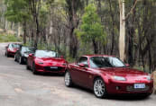
Having plotted a run that would take us to three of Canberra’s water storage dams, I couldn’t resist the temptation to chuck another dam in. Our meet point was the lookout at Scrivener Dam, which was only just large enough for the thirteen cars and 20 members who started from here (we were picking up another car and driver at our first stop). Scrivener Dam was built in the early ‘60s and holds back the Molonglo River to form Lake Burley Griffin. The concrete gravity dam is 33 metres high and 319 metres wide, was built with 55,000 cubic metres of concrete, holds back 33 million cubic metres of water and has a surface area of 664 hectares (approximately seven square kms).
We would be visiting Googong, Corin and Cotter dams on what proved to be an easy-going drive in the country of a little less than 200 kms.
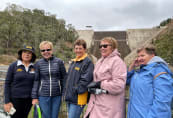
First up was Googong Dam, just the other side of Queanbeyan. Googong is a major component of Canberra’s water supply (the largest), and when we visited was a smidgen under full. Googong is 66 metres high and is 417 metres wide. It holds some 818 million cubic metres of water and has a surface area of 696 hectares, not much more than LBG. After the mandatory photos, accompanied by a bit of drizzle, I briefed the gang on the next leg, and we set off.
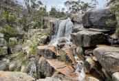
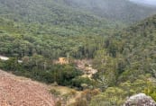
We zoom zoomed out towards Burra and on to Corin Dam, way up in the hills in Namadgi National Park. The drive out was a delight, especially once we got past the southern edges of Canberra and headed out along the Tidbinbilla Road, with its sweeping curves and gorgeous rural views. Taking advantage of the lack of traffic, I decided to pull into Gibraltar Falls on the way up to the dam. Unfortunately, about half of the group seemed to have missed that part of the briefing and I watched as they swept past the turnoff. Most realised they had missed something and turned back but a couple kept going. They had to end up at the dam – there was nowhere else to go – so I took the decision to peek at the falls and catch up with them later. There was plenty of water spilling over the rocks in what I think is one of Canberra’s oft-overlooked attractions. And the visit here was a first for several of the group (including a some who had been in Canberra for donkey’s years) so the stop was most worthwhile.
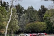
After ten minutes or so, we all fired up the excitement machines and headed off to the dam. The Corin Road was in great condition and an absolute delight to travel. As expected, we had it to ourselves, which was one reason why I’d planned this as a mid-week run. It can be a rewarding drive. Our lost (no, no lost, just ‘temporarily geographically displaced’) friends were waiting for us at the dam carpark (hooray!), which was plenty big enough for us. I’ve been out here several times and the place is always quiet – another hidden gem. (It's a good spot to start some delightful bushwalks, and there are well-kept toilet facilities and picnic tables.)
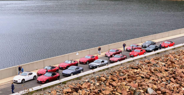
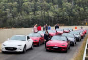
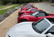
Corin is 74 metres high and 282 metres wide and was chockers, which Icon Water tells us is about 2.5 times the volume of Lake Burley Griffin. Taking full advantage of the absence of any other vehicles, we lined the cars up two abreast along the dam wall as photos were snapped and tales were told. I will not tire of seeing a zoom of MX-5s (surely the collective noun for MX-5s is a ‘zoom’) in their natural environment.
We left Corin and retraced our steps back to Tidbinbilla Road for a short ride to Tidbinbilla for a picnic in the grounds of the information centre. Chairs (and tables) and assorted goodies were extracted for car boots and everyone enjoyed a good old chin-wag as we recounted the beauty of our run so far. Some wandered in the info centre for coffee, drinks, snacks and ice-creams.
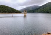
Some while later, and enjoying the intermittent sunshine, we saddled up and headed off to our last stop at the Cotter Dam. Originally built in 1915 to a height of 18 metres, in 1951 the dam wall height was raised to 31 metres, but that was not going to meet the needs of Canberra for long. In 2013 another dam was built a little downstream of the original, this time to a height of 83 metres. This increased the capacity of the Cotter by some 2000%. The Cotter was also chockers. Wandering and photographing as usual, we found we were by no means talked out and enjoyed a leisurely end-of-run rest before heading off home.
Our run presented a rare opportunity to see our water supply at almost 100 percent capacity, while enjoying the company of friends, the joy of our MX-5s and the beauty of our countryside. (Had we taken the run a week later, we would have viewed the even rarer sight of water cascading in almost unimaginable rivers over the dam walls.)
Not a bad way to spend a Wednesday, eh?
There are more photos in my Google album at https://photos.app.goo.gl/FgeUTpbthxGauPJ37.
There are heaps more photos on our Facebook page at https://www.facebook.com/groups/mx5canberra. Thank you to our support photographers Lili Chi, Ron Tollenaar and Jennifer Le. Their photos are certainly worth a peek.
Cheers
Rod & Maryanne Nicholas

